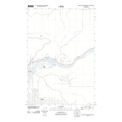
2010 Map of Lewiston Orchards North
USGS Topo · Published 2010About this map
Lewiston Orchards serves as a primary residential anchor in this 2010 depiction of the Nez Perce County landscape, where the plateau drops sharply toward the Clearwater River valley. The map documents the complex transition between the upland neighborhoods and the riverfront industry, connected by steep routes like Thain Grade and the sweeping curves of Lewiston Hill. Along the northern banks of the river, small settlements and named locales such as Hatwai, Valley View Heights, and Gurney sit beneath the shadows of the bluffs. The infrastructure of the era is clearly defined by the Clearwater River Memorial Bridge and the winding Central Grade Rd, which follows the contours of the terrain carved by Hatwai Creek and McGuire Creek. This survey records a period of modern development characterized by residential expansion across the orchards and flats.
Find a feature on this map
36 named features on this map. Tap any name to fly to it.
Don’t see what you’re looking for? This feature index may not catch every label — zoom into the map to look around manually.
Map Details
Editions of this 2010 Lewiston Orchards North Map
This is the sole edition of this map. No revisions or reprints were ever made.
Other maps of this area

1910 · Pullman
USGS Topo · 1:125,000

1945 · Clarkston
USGS Topo · 1:62,500

1948 · Clarkston
USGS Topo · 1:62,500

1955 · Pullman
USGS Topo · 1:250,000

1958 · Pullman
USGS Topo · 1:250,000

1958 · Lapwai
USGS Topo · 1:24,000

1958 · Sweetwater
USGS Topo · 1:24,000

1958 · Lewiston Orchards North
USGS Topo · 1:24,000

1958 · Lewiston Orchards South
USGS Topo · 1:24,000

1958 · Lewiston Orchards
USGS Topo · 1:62,500