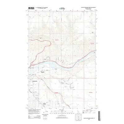
2013 Map of Lewiston Orchards North
USGS Topo · Published 2013About this map
The Clearwater River serves as the central artery for this region of Nez Perce County, carving a path between the steep ascent of Lewiston Hill to the north and the plateau of Lewiston Orchards to the south. This 2013 survey illustrates a landscape defined by significant elevation changes, where residential developments like Valley View Heights and Forebay overlook the river valley. The infrastructure of Lewiston is dense along the southern bank, while the northern side features the industrial and transport corridor of North Lewiston and the winding N and S Hwy. Smaller named points such as Hatwai and Gurney mark the transition from the river basin to the higher ground, where the street grid of the Orchards gives way to canyons like Cole Canyon.
Find a feature on this map
61 named features on this map. Tap any name to fly to it.
Don’t see what you’re looking for? This feature index may not catch every label — zoom into the map to look around manually.
Map Details
Editions of this 2013 Lewiston Orchards North Map
This is the sole edition of this map. No revisions or reprints were ever made.
Other maps of this area

1910 · Pullman
USGS Topo · 1:125,000

1945 · Clarkston
USGS Topo · 1:62,500

1948 · Clarkston
USGS Topo · 1:62,500

1955 · Pullman
USGS Topo · 1:250,000

1958 · Pullman
USGS Topo · 1:250,000

1958 · Lapwai
USGS Topo · 1:24,000

1958 · Sweetwater
USGS Topo · 1:24,000

1958 · Lewiston Orchards North
USGS Topo · 1:24,000

1958 · Lewiston Orchards South
USGS Topo · 1:24,000

1958 · Lewiston Orchards
USGS Topo · 1:62,500