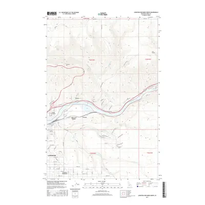
2017 Map of Lewiston Orchards North
USGS Topo · Published 2017About this map
The Clearwater River serves as the central artery of this 2017 landscape, carving a deep valley that separates the northern highlands from the expanding residential developments of Lewiston. To the north, the steep switchbacks of Lewiston Hill and the rugged drainage of Hatwai Cr dominate the terrain, while the southern plateau shows the organized grid of Lewiston Orchards. The map illustrates the transition from the riverfront industrial and transportation corridors of North Lewiston to suburban neighborhoods like Valley View Heights. Historically significant features include the river-adjacent settlement of Hatwai and the infrastructure at Forebay. This modern survey documents the complex topography of the region, from the depths of Cole Canyon to the winding course of Lindsay Cr, capturing the intersection of major highway routes and historic watercourses in Nez Perce County.
Find a feature on this map
65 named features on this map. Tap any name to fly to it.
Don’t see what you’re looking for? This feature index may not catch every label — zoom into the map to look around manually.
Map Details
Editions of this 2017 Lewiston Orchards North Map
This is the sole edition of this map. No revisions or reprints were ever made.
Other maps of this area

1910 · Pullman
USGS Topo · 1:125,000

1945 · Clarkston
USGS Topo · 1:62,500

1948 · Clarkston
USGS Topo · 1:62,500

1955 · Pullman
USGS Topo · 1:250,000

1958 · Pullman
USGS Topo · 1:250,000

1958 · Lapwai
USGS Topo · 1:24,000

1958 · Sweetwater
USGS Topo · 1:24,000

1958 · Lewiston Orchards North
USGS Topo · 1:24,000

1958 · Lewiston Orchards South
USGS Topo · 1:24,000

1958 · Lewiston Orchards
USGS Topo · 1:62,500