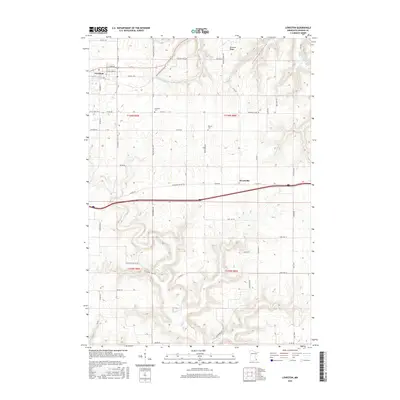
2016 Map of Lewiston
USGS Topo · Published 2016About this map
Lewiston serves as the primary hub in this portion of Winona County, situated atop a plateau where the grid of Fremont St and Williams St meets the agricultural landscape. The geography here is defined by a series of deep valleys and ridges that slice through the prairie. To the north, German Ridge overlooks the long, winding Schoeniger Valley, while the southern reaches are drained by Rush Cr and its tributaries within Ferguson Valley. This complex drainage pattern highlights the driftless-style topography of the region, where roads like Dutchmans Crossing Dr navigate the sudden elevation changes. Local heritage is preserved at the Brethren Cem and Warren Cem, which remain as quiet landmarks along the rural corridors of Almon Dr and Co Hwy 25. In the eastern section, Wyattville marks a small crossroads settlement, anchoring the intersection of Co Hwy 12 and the interstate corridor.
Find a feature on this map
57 named features on this map. Tap any name to fly to it.
Don’t see what you’re looking for? This feature index may not catch every label — zoom into the map to look around manually.
Map Details
Editions of this 2016 Lewiston Map
This is the sole edition of this map. No revisions or reprints were ever made.
Other maps of this area

1929 · Fountain City
USGS Topo · 1:62,500

1932 · Cochrane
USGS Topo · 1:62,500

1934 · Winona
USGS Topo · 1:62,500

1934 · Cochrane
USGS Topo · 1:62,500

1937 · Winona
USGS Topo · 1:62,500

1937 · Cochrane
USGS Topo · 1:62,500

1953 · Eau Claire
USGS Topo · 1:250,000

1954 · Lewiston
USGS Topo · 1:62,500

1958 · Eau Claire
USGS Topo · 1:250,000

1958 · Houston
USGS Topo · 1:62,500