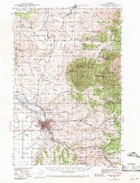
1941 Map of Lewistown
USGS Topo · Published 1971About this map
Lewistown serves as the focal point of this 1941 survey, showing a landscape defined by its mining operations and early industrial infrastructure. The area is marked by a complex network of resource extraction, including the Divide Coal Mine and Skaggs Coal Mine to the east, while an Oil Refinery sits just south of the city center. To the northeast, the Judith Mountains rise sharply, housing inactive operations such as the New Year Mine and Western Mines, signaling a shift in the region's mineral economy.
Find a feature on this map
54 named features on this map. Tap any name to fly to it.
Don’t see what you’re looking for? This feature index may not catch every label — zoom into the map to look around manually.
Map Details
Editions of this 1941 Lewistown Map
3 editions found
Other maps of this area

1889 · Big Snowy Mountain
USGS Topo · 1:250,000

1893 · Big Snowy Mountain
USGS Topo · 1:250,000

1941 · Lewistown
USGS Topo · 1:62,500

1941 · Judith Peak
USGS Topo · 1:62,500

1944 · Lewistown
USGS Topo · 1:62,500

1944 · Judith Peak
USGS Topo · 1:62,500

1954 · Roundup
USGS Topo · 1:250,000

1954 · Lewistown
USGS Topo · 1:250,000

1958 · Roundup
USGS Topo · 1:250,000

1959 · Lewistown
USGS Topo · 1:250,000