
Historical Maps of Fergus County, Montana
What stories do these 188 old maps tell about Fergus County's past? From 1889 to present day, these maps reveal the evolution of streets, neighborhoods, iconic landmarks, and natural features in stunning high-res detail. Whether you're a history enthusiast, genealogist, or professional in education, environmental work, or architecture, these maps are perfect for exploration, research, and discovery.
Discover Fergus County's history through maps:
- Trace Fergus County's growth: Explore earlier and latest maps and editions to uncover how the region changed over time.
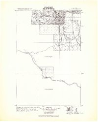
- Examine technical details: Each map includes its creators, publishers, scale, dimensions, and full source information.
- Layer maps with modern tools & imagery: Compare historical maps to modern-day with high-resolution satellite imagery and detailed LiDAR layers.
- Sourced from trusted archives: Carefully preserved and digitized by institutions like the United Stated Geological Survey and the US Library of Congress.
- Access in any format: View and explore in high resolution, download for offline use, or order a museum-quality print for yourself or a loved one.
Begin your journey into Fergus County's history with these remarkable must-see maps.
Fergus County, MT maps
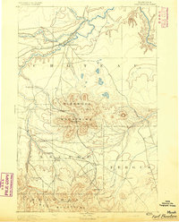
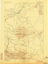
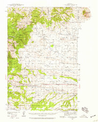
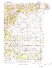
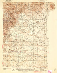
(188)- 1889 Map of Big Snowy Mountain
 1889 Big Snowy Mountain1889 Print · USGSCovers Fergus County, including Harlowton, Ryegate, and other nearby areas
 - 1890 Map of Fort Benton
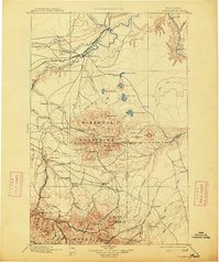
 1890 Fort Benton1890 Print · USGSCovers Fergus County, including Fort Benton, Belt, and other nearby areas
 - 1892 Map of Fort Benton
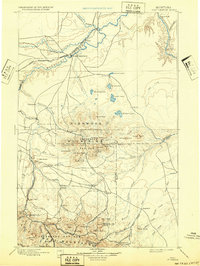
 1892 Fort Benton1892 Print · USGSCovers Fergus County, including Fort Benton, Belt, and other nearby areas
 - 1892 Map of Fort Benton
 1892 Fort Benton1892 Print · USGSCovers Fergus County, including Fort Benton, Belt, and other nearby areas
 - 1893 Map of Big Snowy Mountain
 1893 Big Snowy Mountain1893 Print · USGSCovers Fergus County, including Harlowton, Ryegate, and other nearby areas
 - 1893 Map of Big Snowy Mountain, 1901 Print
 1893 Big Snowy Mountain1901 Print · USGSCovers Fergus County, including Harlowton, Ryegate, and other nearby areas
 - 1893 Map of Big Snowy Mountain, 1909 Print
 1893 Big Snowy Mountain1909 Print · USGSCovers Fergus County, including Harlowton, Ryegate, and other nearby areas
 - 1893 Map of Big Snowy Mountain, 1920 Print
 1893 Big Snowy Mountain1920 Print · USGSCovers Fergus County, including Harlowton, Ryegate, and other nearby areas
 - 1897 Map of Fort Benton
 1897 Fort Benton1897 Print · USGSCovers Fergus County, including Fort Benton, Belt, and other nearby areas
 - 1897 Map of Fort Benton, 1903 Print
 1897 Fort Benton1903 Print · USGSCovers Fergus County, including Fort Benton, Belt, and other nearby areas
 - 1897 Map of Fort Benton, 1914 Print
 1897 Fort Benton1914 Print · USGSCovers Fergus County, including Fort Benton, Belt, and other nearby areas
 - 1897 Map of Fort Benton, 1932 Print
 1897 Fort Benton1932 Print · USGSCovers Fergus County, including Fort Benton, Belt, and other nearby areas
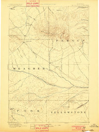
 - 1941 Map of Lewistown, 1959 Print
 1941 Lewistown1959 Print · USGSCovers Fergus County, including Lewistown, New Year, and other nearby areas
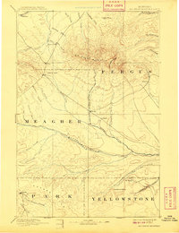
 - 1941 Map of Judith Peak, 1959 Print
 1941 Judith Peak1959 Print · USGSCovers Fergus County, including Maiden, Giltedge, and other nearby areas
 - 1941 Map of Lewistown, 1971 Print
 1941 Lewistown1971 Print · USGSCovers Fergus County, including Lewistown, New Year, and other nearby areas
 - 1941 Map of Judith Peak, 1972 Print
 1941 Judith Peak1972 Print · USGSCovers Fergus County, including Maiden, Giltedge, and other nearby areas
 - 1941 Map of Lewistown, 1975 Print
 1941 Lewistown1975 Print · USGSCovers Fergus County, including Lewistown, New Year, and other nearby areas
 - 1941 Map of Judith Peak, 1978 Print
 1941 Judith Peak1978 Print · USGSCovers Fergus County, including Maiden, Giltedge, and other nearby areas
 - 1943 Map of Landusky
 1943 Landusky1943 Print · USGSCovers Fergus County, including Lodge Pole, Hays, and other nearby areas
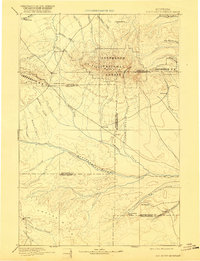
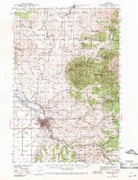
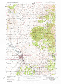
 - 1944 Map of Lewistown
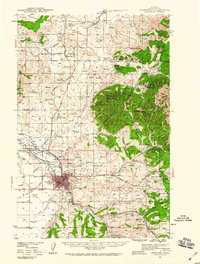
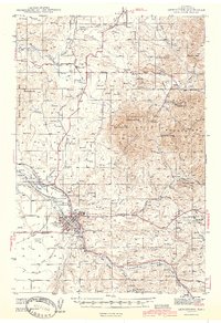
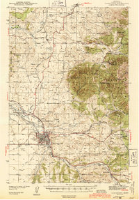 1944 Lewistown1944 Print · USGSCovers Fergus County, including Lewistown, New Year, and other nearby areas
 - 1944 Map of Lewistown
 1944 Lewistown1944 Print · USGSCovers Fergus County, including Lewistown, New Year, and other nearby areas
 - 1944 Map of Judith Peak
 1944 Judith Peak1944 Print · USGSCovers Fergus County, including Maiden, Giltedge, and other nearby areas
 - 1944 Map of Judith Peak
 1944 Judith Peak1944 Print · USGSCovers Fergus County, including Maiden, Giltedge, and other nearby areas
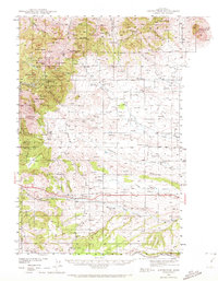
 - 1953 Map of Starve Out Flat, 1955 Print
 1953 Starve Out Flat1955 Print · USGSCovers Fergus County, including Chouteau County, United States, and other nearby areas
 - 1953 Map of Starve Out Flat, 1976 Print
 1953 Starve Out Flat1976 Print · USGSCovers Fergus County, including Chouteau County, United States, and other nearby areas
Showing maps 1-25 of 188
Top cities in Fergus County
- Lewistown historical maps
- Denton historical maps
- Moore historical maps
- Winifred historical maps
- Grass Range historical maps
Frequently asked questions
- What are the different types of historical maps available for Fergus County?
- What is the oldest map of Fergus County?
- Where can I purchase historical maps of Fergus County for my home or office?
- Where can I download high-res historical maps of Fergus County?
- Are there historical topographic maps available for Fergus County?
- Is there historical aerial imagery available for Fergus County?
- Where are historical maps of Fergus County sourced from?