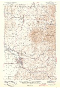
1944 Map of Lewistown
USGS Topo · Published 1944About this map
Lewistown serves as the industrial and transportation hub of central Fergus County in the early 1940s, anchored by its Oil Refinery and a complex network of railroads. The Chicago Milwaukee St Paul and Pacific and Great Northern lines converge at junctions like Roy Winifred Junc and Lewistown Junc, supporting a local economy built on mining and agriculture. To the northeast, the Judith Mountains rise sharply, dotted with historical mining operations such as the New Year Mine and Western Mines, both noted as inactive by this time. The map reveals a community well-served by civic infrastructure, from the County Fairgrounds and Lewistown Airport to several rural schoolhouses like Standard Sch and Lucier Sch. Coal mining remains active along the southern ridges, evidenced by the Divide Coal Mine and Skaggs Coal Mine near the settlement of Heath.
Find a feature on this map
64 named features on this map. Tap any name to fly to it.
Don’t see what you’re looking for? This feature index may not catch every label — zoom into the map to look around manually.
Map Details
Editions of this 1944 Lewistown Map
2 editions found
Other maps of this area

1889 · Big Snowy Mountain
USGS Topo · 1:250,000

1893 · Big Snowy Mountain
USGS Topo · 1:250,000

1941 · Lewistown
USGS Topo · 1:62,500

1941 · Judith Peak
USGS Topo · 1:62,500

1944 · Lewistown
USGS Topo · 1:62,500

1944 · Judith Peak
USGS Topo · 1:62,500

1954 · Roundup
USGS Topo · 1:250,000

1954 · Lewistown
USGS Topo · 1:250,000

1958 · Roundup
USGS Topo · 1:250,000

1959 · Lewistown
USGS Topo · 1:250,000