
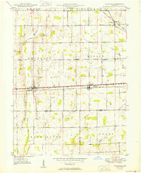
1950 Map of Lewisville
USGS Topo · Published 1950About this map
The town of Lewisville serves as a central hub on this 1950 map, situated at the intersection of the Pennsylvania railroad and the highway. This survey captures a post-war landscape where small agricultural centers like Straughn and New Lisbon remained anchored by their transit connections. The distribution of rural landmarks, including Rich Square Ch and Salem Ch, reveals the organized social fabric of Franklin and Dudley townships during this era.
Find a feature on this map
25 named features on this map. Tap any name to fly to it.
Don’t see what you’re looking for? This feature index may not catch every label — zoom into the map to look around manually.
Map Details
Editions of this 1950 Lewisville Map
2 editions found
Other maps of this area

1948 · Lewisville
USGS Topo · 1:24,000

1949 · New Castle West
USGS Topo · 1:24,000

1950 · New Castle East
USGS Topo · 1:24,000

1950 · Dunreith
USGS Topo · 1:24,000

1953 · Cincinnati
USGS Topo · 1:250,000

1956 · Connersville
USGS Topo · 1:24,000

1957 · Cincinnati
USGS Topo · 1:250,000

1959 · Mays
USGS Topo · 1:24,000

1959 · Falmouth
USGS Topo · 1:24,000

1960 · New Castle West
USGS Topo · 1:24,000