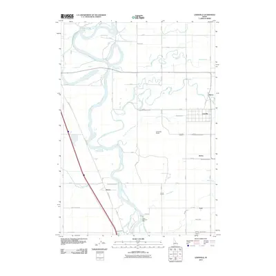
2010 Map of Lewisville
USGS Topo · Published 2010About this map
The Snake River carves a complex path through this part of Jefferson County, defining a landscape dominated by a sophisticated network of irrigation infrastructure. This 2010 survey illustrates the vital role of water management in the region, featuring the Idaho Diversion Dam and an extensive system of waterways including the Butte Market Lake Canal, Great Western Canal, and Long Island Canal. These channels support the agricultural settlements of Lewisville, Grant, and Bassett, which are connected by a grid of rural roads like Farm to Market Rd.
Find a feature on this map
54 named features on this map. Tap any name to fly to it.
Don’t see what you’re looking for? This feature index may not catch every label — zoom into the map to look around manually.
Map Details
Editions of this 2010 Lewisville Map
This is the sole edition of this map. No revisions or reprints were ever made.
Other maps of this area

1948 · Rigby
USGS Topo · 1:24,000

1948 · Lewisville
USGS Topo · 1:24,000

1948 · Idaho Falls North
USGS Topo · 1:24,000

1948 · Ucon
USGS Topo · 1:24,000

1949 · Ucon
USGS Topo · 1:24,000

1949 · Idaho Falls North
USGS Topo · 1:24,000

1949 · Rigby
USGS Topo · 1:24,000

1949 · Lewisville
USGS Topo · 1:24,000

1949 · Roberts
USGS Topo · 1:62,500

1949 · Roberts
USGS Topo · 1:24,000