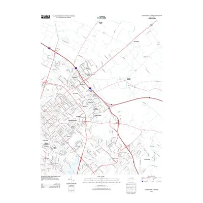
2013 Map of Lexington East
USGS Topo · Published 2013About this map
Ashland Park and the established neighborhoods of eastern Lexington anchor this 2013 survey, showing the dense residential growth and historic estates of the Bluegrass region. The map tracks the suburban transition from the city center outward to settlements like Thoroughbred Acres and Dixie Plantation, highlighting the intersection of modern development and traditional horse country. To the northeast, the landscape opens into larger tracts such as Elmendorf and the area surrounding Russell Cave. Key water features including Cane Run and the North Elkhorn Creek system wind through the terrain, alongside a series of municipal water sources like Reservoir Number 1. Historical landmarks such as Howards Grove Cemetery and the Bryan Station Spring provide essential points of reference for genealogists and local historians studying the evolution of Fayette County.
Find a feature on this map
364 named features on this map. Tap any name to fly to it.
Don’t see what you’re looking for? This feature index may not catch every label — zoom into the map to look around manually.
Map Details
Editions of this 2013 Lexington East Map
This is the sole edition of this map. No revisions or reprints were ever made.
Other maps of this area

1892 · Richmond
USGS Topo · 1:125,000

1897 · Richmond
USGS Topo · 1:125,000

1905 · Harrodsburg
USGS Topo · 1:125,000

1906 · Georgetown
USGS Topo · 1:62,500

1908 · Georgetown
USGS Topo · 1:62,500

1927 · Lexington
USGS Topo · 1:48,000

1929 · Lexington
USGS Topo · 1:62,500

1950 · Lexington East
USGS Topo · 1:24,000

1950 · Lexington West
USGS Topo · 1:24,000

1952 · Nicholasville
USGS Topo · 1:24,000