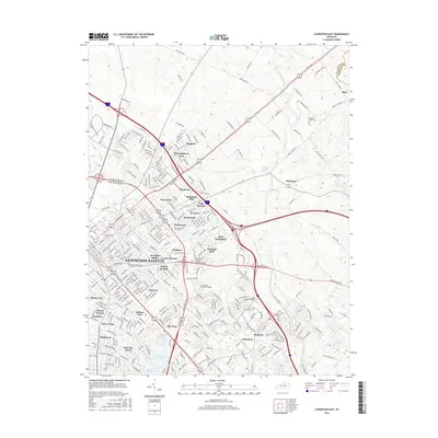
2016 Map of Lexington East
USGS Topo · Published 2016About this map
Lexington-Fayette dominates the landscape of the Bluegrass region in this detailed survey, showcasing a mix of dense urban development and the sprawling estates that characterize the area's equestrian identity. Prominent educational institutions like Transylvania Univ and Spencarian Coll anchor the city center, while named neighborhoods such as Ashland Park and Chevy Chase illustrate the established residential fabric of the mid-2010s.
Find a feature on this map
287 named features on this map. Tap any name to fly to it.
Don’t see what you’re looking for? This feature index may not catch every label — zoom into the map to look around manually.
Map Details
Editions of this 2016 Lexington East Map
This is the sole edition of this map. No revisions or reprints were ever made.
Other maps of this area

1892 · Richmond
USGS Topo · 1:125,000

1897 · Richmond
USGS Topo · 1:125,000

1905 · Harrodsburg
USGS Topo · 1:125,000

1906 · Georgetown
USGS Topo · 1:62,500

1908 · Georgetown
USGS Topo · 1:62,500

1927 · Lexington
USGS Topo · 1:48,000

1929 · Lexington
USGS Topo · 1:62,500

1950 · Lexington East
USGS Topo · 1:24,000

1950 · Lexington West
USGS Topo · 1:24,000

1952 · Nicholasville
USGS Topo · 1:24,000