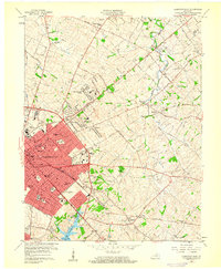
1959 Map of Lexington East
USGS Topo · Published 1960About this map
The urban core of Lexington and its surrounding Bluegrass country are captured here at a moment of significant mid-century expansion. The development of suburban enclaves like Thoroughbred Acres, Hi-Acres, and Chevy Chase contrasts with established landmarks such as Transylvania University and the Home of Henry Clay. This survey provides an exact look at the city's growth before the full enclosure of the city by bypasses, showing the early layout of the New Circle Road corridor.
Find a feature on this map
69 named features on this map. Tap any name to fly to it.
Don’t see what you’re looking for? This feature index may not catch every label — zoom into the map to look around manually.
Map Details
Editions of this 1959 Lexington East Map
This is the sole edition of this map. No revisions or reprints were ever made.
Other maps of this area

1892 · Richmond
USGS Topo · 1:125,000

1897 · Richmond
USGS Topo · 1:125,000

1905 · Harrodsburg
USGS Topo · 1:125,000

1906 · Georgetown
USGS Topo · 1:62,500

1908 · Georgetown
USGS Topo · 1:62,500

1927 · Lexington
USGS Topo · 1:48,000

1929 · Lexington
USGS Topo · 1:62,500

1950 · Lexington East
USGS Topo · 1:24,000

1950 · Lexington West
USGS Topo · 1:24,000

1952 · Nicholasville
USGS Topo · 1:24,000