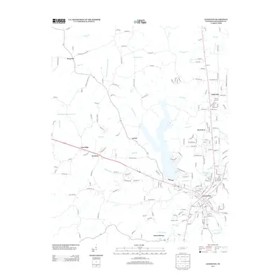
2013 Map of Lexington
USGS Topo · Published 2013About this map
Lexington serves as the central hub of this West Tennessee landscape, where the Beech River and its various tributaries like Onemile Br and Town Br shape the local topography. The map illustrates a complex network of rural communities including Antioch, Sand Ridge, and Broadway, alongside the more substantial development at Timberlake. Local water resources are prominent, featuring the Big Sandy River in the north and the Middle Fork Forked Deer River to the west. This 2013 survey provides a detailed view of the regional transition from suburban clusters to agricultural lands, with features like Carrington Pond and Graper Spring highlighting the area's natural hydrology. The dense web of named roads, such as Sand Ridge Bargerton Rd and McCaney Mill Rd, reveals the enduring path of local travel through Henderson County.
Find a feature on this map
187 named features on this map. Tap any name to fly to it.
Don’t see what you’re looking for? This feature index may not catch every label — zoom into the map to look around manually.
Map Details
Editions of this 2013 Lexington Map
This is the sole edition of this map. No revisions or reprints were ever made.
Other maps of this area

1936 · Clarksburg
USGS Topo · 1:24,000

1936 · Lexington
USGS Topo · 1:24,000

1936 · Yuma
USGS Topo · 1:24,000

1936 · Reagan
USGS Topo · 1:24,000

1936 · Life
USGS Topo · 1:24,000

1936 · Chesterfield
USGS Topo · 1:24,000

1950 · Reagan
USGS Topo · 1:24,000

1950 · Life
USGS Topo · 1:24,000

1950 · Yuma
USGS Topo · 1:24,000

1950 · Lexington
USGS Topo · 1:24,000