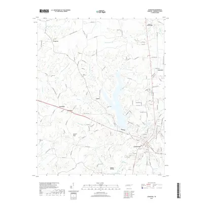
2019 Map of Lexington
USGS Topo · Published 2019About this map
The Tennessee Valley Divide snakes through the center of this Henderson County landscape, separating the headwaters of the Middle Fork Forked Deer River from the Beech River basin. Lexington serves as the regional hub, situated amidst a network of small outlying settlements including Bargerton, Sand Ridge, and Parker's Crossroads. The geography is defined by its numerous small drainages and springs, such as Graper Spring and Wolf Creek, which flow through the dissected terrain south of the divide.
Find a feature on this map
144 named features on this map. Tap any name to fly to it.
Don’t see what you’re looking for? This feature index may not catch every label — zoom into the map to look around manually.
Map Details
Editions of this 2019 Lexington Map
This is the sole edition of this map. No revisions or reprints were ever made.
Other maps of this area

1936 · Clarksburg
USGS Topo · 1:24,000

1936 · Lexington
USGS Topo · 1:24,000

1936 · Yuma
USGS Topo · 1:24,000

1936 · Reagan
USGS Topo · 1:24,000

1936 · Life
USGS Topo · 1:24,000

1936 · Chesterfield
USGS Topo · 1:24,000

1950 · Reagan
USGS Topo · 1:24,000

1950 · Life
USGS Topo · 1:24,000

1950 · Yuma
USGS Topo · 1:24,000

1950 · Lexington
USGS Topo · 1:24,000