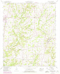
1952 Map of Lexington
USGS Topo · Published 1973About this map
The agricultural landscape of northern Alabama is captured here by the Tennessee Valley Authority, centering on the small hubs of Lexington and Anderson. This period is defined by a dense network of country roads connecting dispersed family farms and community centers like Whitehead. The map reveals a high concentration of small rural congregations and burying grounds, including Nebo Ch, Corum Chapel, and the Portertown Cem.
Find a feature on this map
62 named features on this map. Tap any name to fly to it.
Don’t see what you’re looking for? This feature index may not catch every label — zoom into the map to look around manually.
Map Details
Editions of this 1952 Lexington Map
2 editions found
Other maps of this area

1914 · Rogersville
USGS Topo · 1:48,000

1916 · Rogersville
USGS Topo · 1:62,500

1936 · Union Hill
USGS Topo · 1:24,000

1936 · Thorntontown
USGS Topo · 1:24,000

1936 · Lexington
USGS Topo · 1:24,000

1936 · Loretto
USGS Topo · 1:24,000

1936 · Wheeler Dam
USGS Topo · 1:24,000
1936 · Center Hill
USGS Topo · 1:24,000

1936 · Appleton
USGS Topo · 1:24,000

1936 · Cairo
USGS Topo · 1:24,000