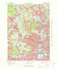
1971 Map of Lexington
USGS Topo · Published 1978About this map
Metropolitan State Hospital and the McLean Hospital complex dominate the southern landscape of this Middlesex County region, highlighting the era's institutional presence. The survey captures a dense network of suburban growth across Lexington, Arlington, and Belmont, where residential expansion is clearly defined against remaining green spaces like the Middlesex Fells Reservation and the Great Meadows. Transportation infrastructure is a central theme, with the Boston and Maine railroad cutting through the terrain and several modern interchanges, including Interchange 42, signaling the rise of the automobile commute. Cultural and academic landmarks such as Bentley College and the Harvard Observatory sit alongside numerous neighborhood schools like Kennedy Mem Jr High Sch and Wyman Sch. Water features including the Upper and Lower Mystic Lake and Fresh Pond provide a natural counterpoint to the accelerating development of the early 1970s.
Find a feature on this map
204 named features on this map. Tap any name to fly to it.
Don’t see what you’re looking for? This feature index may not catch every label — zoom into the map to look around manually.
Map Details
Editions of this 1971 Lexington Map
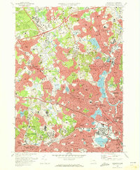
2 editions found
Other maps of this area

1886 · Lawrence
USGS Topo · 1:62,500

1886 · Lowell
USGS Topo · 1:62,500

1886 · Framingham
USGS Topo · 1:62,500

1888 · Lawrence
USGS Topo · 1:62,500

1889 · Framingham
USGS Topo · 1:62,500

1893 · Lowell
USGS Topo · 1:62,500

1893 · Boston
USGS Topo · 1:62,500

1893 · Lawrence
USGS Topo · 1:62,500

1894 · Framingham
USGS Topo · 1:62,500

1903 · Boston
USGS Topo · 1:62,500