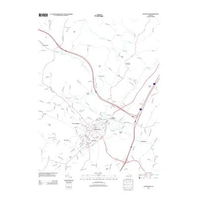
2013 Map of Lexington
USGS Topo · Published 2013About this map
Lexington serves as the focal point of this 2013 survey, where the confluence of the Maury River and several tributary runs defines the local geography. The map captures the community's civic and historical architecture through landmarks such as Memorial Gate and the distinctively named Lawyers Row and Godwins Row. Surrounding the central town, several smaller settlements and neighborhoods are documented, including Newtown, Mudtown, and East Lexington, providing a detailed view of the area's residential growth pattern.
Find a feature on this map
185 named features on this map. Tap any name to fly to it.
Don’t see what you’re looking for? This feature index may not catch every label — zoom into the map to look around manually.
Map Details
Editions of this 2013 Lexington Map
This is the sole edition of this map. No revisions or reprints were ever made.
Other maps of this area

1894 · Natural Bridge
USGS Topo · 1:125,000

1894 · Lexington
USGS Topo · 1:125,000

1894 · Natural Bridge
USGS Topo · 1:62,500

1907 · Natural Bridge Special
USGS Topo · 1:62,500

1932 · Lexington
USGS Topo · 1:48,000

1935 · Buena Vista
USGS Topo · 1:48,000

1937 · Lexington
USGS Topo · 1:62,500

1939 · Buena Vista
USGS Topo · 1:62,500

1940 · Buena Vista
USGS Topo · 1:62,500

1946 · Millboro
USGS Topo · 1:62,500