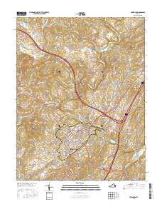
2016 Map of Lexington
USGS Topo · Published 2016About this map
The academic and cultural core of Lexington is anchored by the historic campuses of the Virginia Military Institute and Washington and Lee Univ, whose grounds and the adjacent VMI Parade occupy the northern heights of the city. The landscape is defined by the winding course of the Maury River, which passes through distinctive geography at Horseshoe Bend and beneath the overlook at Lovers Leap. This 2016 survey captures the intersection of academic tradition and the surrounding rural terrain, from the hills of Newtown to the river crossings at Limekiln Bridge.
Find a feature on this map
176 named features on this map. Tap any name to fly to it.
Don’t see what you’re looking for? This feature index may not catch every label — zoom into the map to look around manually.
Map Details
Editions of this 2016 Lexington Map
This is the sole edition of this map. No revisions or reprints were ever made.
Other maps of this area

1894 · Natural Bridge
USGS Topo · 1:125,000

1894 · Lexington
USGS Topo · 1:125,000

1894 · Natural Bridge
USGS Topo · 1:62,500

1907 · Natural Bridge Special
USGS Topo · 1:62,500

1932 · Lexington
USGS Topo · 1:48,000

1935 · Buena Vista
USGS Topo · 1:48,000

1937 · Lexington
USGS Topo · 1:62,500

1939 · Buena Vista
USGS Topo · 1:62,500

1940 · Buena Vista
USGS Topo · 1:62,500

1946 · Millboro
USGS Topo · 1:62,500