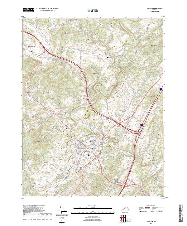
2022 Map of Lexington
USGS Topo · Published 2022About this map
Lexington serves as the focal point of this Rockbridge County survey, where the historic campuses of Washington and Lee University and the Virginia Military Institute sit adjacent to the city center. The urban grid is clearly defined, showing the Rockbridge County Courthouse and residential growth extending into neighborhoods like Newtown and Thorn Hill. Outside the city, the landscape is shaped by the winding Maury River and its various tributaries, including Whistle Creek and Woods Creek.
Find a feature on this map
169 named features on this map. Tap any name to fly to it.
Don’t see what you’re looking for? This feature index may not catch every label — zoom into the map to look around manually.
Map Details
Editions of this 2022 Lexington Map
This is the sole edition of this map. No revisions or reprints were ever made.
Other maps of this area

1894 · Natural Bridge
USGS Topo · 1:125,000

1894 · Lexington
USGS Topo · 1:125,000

1894 · Natural Bridge
USGS Topo · 1:62,500

1907 · Natural Bridge Special
USGS Topo · 1:62,500

1932 · Lexington
USGS Topo · 1:48,000

1935 · Buena Vista
USGS Topo · 1:48,000

1937 · Lexington
USGS Topo · 1:62,500

1939 · Buena Vista
USGS Topo · 1:62,500

1940 · Buena Vista
USGS Topo · 1:62,500

1946 · Millboro
USGS Topo · 1:62,500