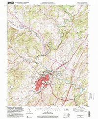
1999 Map of Lexington
USGS Topo · Published 2000About this map
Lexington serves as the institutional heart of this late-20th-century landscape, anchored by the expansive campuses of the Virginia Military Institute and Washington & Lee University. The city's street grid is marked by civic landmarks including the Courthouse, City Hall, and the Stonewall Jackson Hospital. Beyond the urban core, the terrain transitions into the steep ridges of Poorhouse Mtn and Brushy Hill, where the Maury River carves a dramatic path through Horseshoe Bend and past Lovers Leap. This survey reveals the area's religious and educational foundations through scattered sites like Old Monmouth Cem, Lee Chapel, and the Highland Belle Sch. The landscape is a composite of traditional valley settlement and modern infrastructure, featuring an Old Railroad Grade and a Drive-in Theater situated near the intersection of the Maury River and South River.
Find a feature on this map
64 named features on this map. Tap any name to fly to it.
Don’t see what you’re looking for? This feature index may not catch every label — zoom into the map to look around manually.
Map Details
Editions of this 1999 Lexington Map
This is the sole edition of this map. No revisions or reprints were ever made.
Other maps of this area

1894 · Natural Bridge
USGS Topo · 1:125,000

1894 · Lexington
USGS Topo · 1:125,000

1894 · Natural Bridge
USGS Topo · 1:62,500

1907 · Natural Bridge Special
USGS Topo · 1:62,500

1932 · Lexington
USGS Topo · 1:48,000

1935 · Buena Vista
USGS Topo · 1:48,000

1937 · Lexington
USGS Topo · 1:62,500

1939 · Buena Vista
USGS Topo · 1:62,500

1940 · Buena Vista
USGS Topo · 1:62,500

1946 · Millboro
USGS Topo · 1:62,500