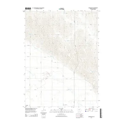
2014 Map of Lexington SE
USGS Topo · Published 2014About this map
The settlement of Josselyn anchors the southwestern corner of this landscape in south-central Nebraska, where the Platte River valley's intricate irrigation systems dominate the local geography. The Dawson County Canal carves a significant path through the terrain, serving as a vital artery for the region's agricultural economy. This network is supported by numerous small, named water storage features such as Hubbard Reservoir, Beatty Reservoir, and Cloatre Reservoir, which are strategically positioned to manage water resources across the plains.
Find a feature on this map
22 named features on this map. Tap any name to fly to it.
Don’t see what you’re looking for? This feature index may not catch every label — zoom into the map to look around manually.
Map Details
Editions of this 2014 Lexington SE Map
This is the sole edition of this map. No revisions or reprints were ever made.
Other maps of this area

1896 · Lexington
USGS Topo · 1:125,000

1896 · Kearney
USGS Topo · 1:125,000

1899 · Lexington
USGS Topo · 1:125,000

1955 · Grand Island
USGS Topo · 1:250,000

1957 · Grand Island
USGS Topo · 1:250,000

1958 · Grand Island
USGS Topo · 1:250,000

1961 · Elm Creek West
USGS Topo · 1:24,000

1961 · Miller SW
USGS Topo · 1:24,000

1962 · Lexington SE
USGS Topo · 1:24,000
1962 · Miller
USGS Topo · 1:24,000