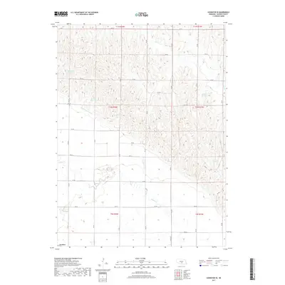
2017 Map of Lexington SE
USGS Topo · Published 2017About this map
Josselyn anchors the southwestern corner of this Nebraska landscape, a small settlement positioned near the southern reaches of the Dawson County Canal. The terrain is defined by a sophisticated water management network, featuring several named reservoirs that support the local agricultural economy. Features like Hammond Reservoir, Hubbard Reservoir, and Beatty Reservoir are integrated into the rolling topography, while Buffalo Cr and Elm Cr provide natural drainage through the various townships. This area illustrates the extensive irrigation and rural infrastructure characteristic of the Platte River valley region. A dense grid of numbered roads, such as RD 755 and Lincoln St, connects the dispersed homesteads and farmsteads throughout Dawson County.
Find a feature on this map
27 named features on this map. Tap any name to fly to it.
Don’t see what you’re looking for? This feature index may not catch every label — zoom into the map to look around manually.
Map Details
Editions of this 2017 Lexington SE Map
This is the sole edition of this map. No revisions or reprints were ever made.
Other maps of this area

1896 · Lexington
USGS Topo · 1:125,000

1896 · Kearney
USGS Topo · 1:125,000

1899 · Lexington
USGS Topo · 1:125,000

1955 · Grand Island
USGS Topo · 1:250,000

1957 · Grand Island
USGS Topo · 1:250,000

1958 · Grand Island
USGS Topo · 1:250,000

1961 · Elm Creek West
USGS Topo · 1:24,000

1961 · Miller SW
USGS Topo · 1:24,000

1962 · Lexington SE
USGS Topo · 1:24,000
1962 · Miller
USGS Topo · 1:24,000