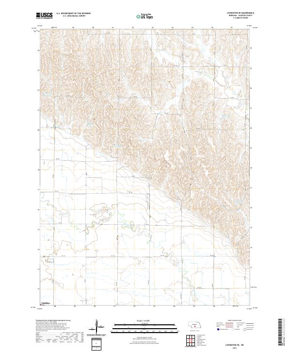
2021 Map of Lexington SE
USGS Topo · Published 2021About this map
The low-lying settlement of Josselyn sits in the southwestern corner of this landscape, positioned where the flat bottomlands of the Platte River valley meet the rising dissected hills of Dawson County. This 2021 survey reveals a complex network of upland water management, characterized by numerous small basins such as Hammond Reservoir, Beatty Reservoir, and Cloatre Reservoir. These features, alongside Hubbard Reservoir and Freeburg Reservoir to the east, suggest a highly modified agricultural environment designed to capture and hold runoff within the rolling terrain. Drainage follows the natural contours through Buffalo Cr and Elm Cr, while a rigid grid of rural roads including Lincoln St and various numbered routes like RD 754 and RD 440 provides access across the section lines. The map captures the intersection of natural Nebraska hydrology and the enduring Public Land Survey System that organizes the local geography.
Find a feature on this map
35 named features on this map. Tap any name to fly to it.
Don’t see what you’re looking for? This feature index may not catch every label — zoom into the map to look around manually.
Map Details
Editions of this 2021 Lexington SE Map
This is the sole edition of this map. No revisions or reprints were ever made.
Other maps of this area

1896 · Lexington
USGS Topo · 1:125,000

1896 · Kearney
USGS Topo · 1:125,000

1899 · Lexington
USGS Topo · 1:125,000

1955 · Grand Island
USGS Topo · 1:250,000

1957 · Grand Island
USGS Topo · 1:250,000

1958 · Grand Island
USGS Topo · 1:250,000

1961 · Elm Creek West
USGS Topo · 1:24,000

1961 · Miller SW
USGS Topo · 1:24,000

1962 · Lexington SE
USGS Topo · 1:24,000
1962 · Miller
USGS Topo · 1:24,000