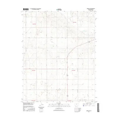
2016 Map of Liberal NW
USGS Topo · Published 2016About this map
The Cimarron River carves a winding path across the northern reaches of this Seward County landscape, defining the topography of the High Plains in southwest Kansas. This 2016 survey illustrates the intersection of natural hydrology and the rigid Public Land Survey System, where the section lines of t32s r33w and t33s r34w dictate the modern road network. The landscape is primarily defined by large-scale agricultural divisions and the straight-line paths of Co Rd 9 and Co Rd 7. Local transit and land access are facilitated by a systematic grid, including significant thoroughfares such as 7 Mile Rd and Seven Mile Rd, which cross the open terrain south of the river valley. The eastern edge of the quadrangle shows signs of more concentrated development along Country Estates Rd, reflecting the gradual outward growth from the nearby regional hub.
Find a feature on this map
29 named features on this map. Tap any name to fly to it.
Don’t see what you’re looking for? This feature index may not catch every label — zoom into the map to look around manually.
Map Details
Editions of this 2016 Liberal NW Map
This is the sole edition of this map. No revisions or reprints were ever made.
Other maps of this area

1944 · Moscow
USGS Topo · 1:62,500

1945 · Moscow
USGS Topo · 1:62,500

1955 · Dodge City
USGS Topo · 1:250,000

1958 · Dodge City
USGS Topo · 1:250,000

1959 · Dodge City
USGS Topo · 1:250,000

1968 · Sublette SW
USGS Topo · 1:24,000

1968 · Liberal NE
USGS Topo · 1:24,000

1968 · Sublette SE
USGS Topo · 1:24,000

1968 · Liberal NW
USGS Topo · 1:24,000

1971 · Liberal
USGS Topo · 1:24,000