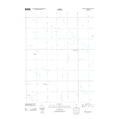
2013 Map of Liberty Center
USGS Topo · Published 2013About this map
Liberty Center serves as the primary hub in this portion of Wells County, situated at the intersection of S Main St and W 300 S. The surrounding landscape is defined by an extensive and organized drainage network, essential for the agricultural productivity of the region. Dozens of named waterways, including Whitelock Ditch, Mossburg Ditch, and Brown Wolf Ditch, crisscross the township lines, illustrating the engineering required to manage the flat Indiana terrain. To the south, the Salamonie River meanders toward the corner of the map, while smaller settlements like Buckeye and Mount Zion mark historic crossroads. Aviation history is represented by Miller Airport on the eastern edge, while the dense grid of county roads provides a clear view of the area's rural settlement patterns and property divisions.
Find a feature on this map
49 named features on this map. Tap any name to fly to it.
Don’t see what you’re looking for? This feature index may not catch every label — zoom into the map to look around manually.
Map Details
Editions of this 2013 Liberty Center Map
This is the sole edition of this map. No revisions or reprints were ever made.
Other maps of this area

1950 · Warren
USGS Topo · 1:24,000

1952 · Warren
USGS Topo · 1:24,000

1952 · Majenica
USGS Topo · 1:24,000

1953 · Muncie
USGS Topo · 1:250,000

1955 · Markle
USGS Topo · 1:24,000

1956 · Muncie
USGS Topo · 1:250,000

1962 · Uniondale
USGS Topo · 1:24,000

1962 · Montpelier
USGS Topo · 1:24,000

1962 · Liberty Center
USGS Topo · 1:24,000

1962 · Roll
USGS Topo · 1:24,000