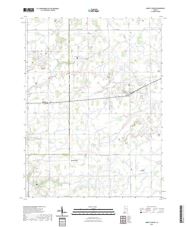
2022 Map of Liberty Center
USGS Topo · Published 2022About this map
Liberty Center and the surrounding agricultural landscape of Wells and Huntington counties are defined by a complex network of man-made waterways. This grid of drainage ditches, including Mossburg Ditch, Merriman Ditch, and Lucky Ditch, reflects the systematic transformation of the local terrain for intensive farming. Small rural settlements like Buckeye and Mount Zion anchor the intersections of straight country roads, while the Salamonie River cuts through the southwestern corner near Batson Cem. Family and local history are preserved in several burial grounds scattered across the townships, such as Thompson Cem and Jones Cem. The map illustrates the persistent structure of the Public Land Survey System, with section lines and township boundaries like t26n r10e guiding the placement of every farmstead and airfield, such as Miller Airport near the eastern edge.
Find a feature on this map
99 named features on this map. Tap any name to fly to it.
Don’t see what you’re looking for? This feature index may not catch every label — zoom into the map to look around manually.
Map Details
Editions of this 2022 Liberty Center Map
This is the sole edition of this map. No revisions or reprints were ever made.
Other maps of this area

1950 · Warren
USGS Topo · 1:24,000

1952 · Warren
USGS Topo · 1:24,000

1952 · Majenica
USGS Topo · 1:24,000

1953 · Muncie
USGS Topo · 1:250,000

1955 · Markle
USGS Topo · 1:24,000

1956 · Muncie
USGS Topo · 1:250,000

1962 · Uniondale
USGS Topo · 1:24,000

1962 · Montpelier
USGS Topo · 1:24,000

1962 · Liberty Center
USGS Topo · 1:24,000

1962 · Roll
USGS Topo · 1:24,000