
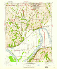
1935 Map of Liberty
USGS Topo · Published 1955About this map
William Jewell College and the Odd Fellows Home anchor the northern hills of this mid-1930s landscape, where the Missouri River forms a massive sweeping bend. The river corridor serves as a busy industrial and transit artery, evidenced by the cluster of rail lines including the Chicago Burlington and Quincy and the Wabash. South of the bluffs, the floodplain transitions into specialized settlements and facilities, such as the Federal Transient Camp and the industrial outpost at Cement City.
Find a feature on this map
56 named features on this map. Tap any name to fly to it.
Don’t see what you’re looking for? This feature index may not catch every label — zoom into the map to look around manually.
Map Details
Editions of this 1935 Liberty Map
2 editions found
Other maps of this area

1890 · Kansas City
USGS Topo · 1:125,000

1894 · Kansas City
USGS Topo · 1:125,000

1894 · Independence
USGS Topo · 1:125,000

1914 · Smithville
USGS Topo · 1:62,500

1933 · Blue Springs
USGS Topo · 1:24,000

1934 · Independence
USGS Topo · 1:24,000

1935 · Kansas City
USGS Topo · 1:24,000

1935 · Missouri City
USGS Topo · 1:24,000

1935 · North Kansas City
USGS Topo · 1:24,000

1936 · Kearney
USGS Topo · 1:48,000