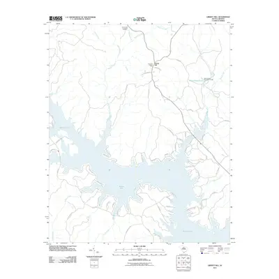
2011 Map of Liberty Hill
USGS Topo · Published 2011About this map
The settlement of Liberty Hill serves as the focal point for this landscape where the Piedmont meets the expansive waters of Wateree Lake. This 2011 survey documents a mix of historic rural infrastructure and contemporary shoreline development. Local history is anchored by the Summerville-Cunningham Cemetery and the Liberty Hill Lookout Tower, which overlooks a topography defined by numerous drainages including Singleton Creek, McDow Creek, and Beaver Creek. The map provides specific insights into water management and land use, noting the Hilton House Pond Dam D-1139 near Hilton House Pond. Road names like Peays Ferry Rd and Sailing Club Rd hint at the area's transition from early river-crossing routes to its modern role as a recreational hub centered on the lake's many coves and inlets.
Find a feature on this map
62 named features on this map. Tap any name to fly to it.
Don’t see what you’re looking for? This feature index may not catch every label — zoom into the map to look around manually.
Map Details
Editions of this 2011 Liberty Hill Map
This is the sole edition of this map. No revisions or reprints were ever made.
Other maps of this area

1935 · Camden
USGS Topo · 1:48,000

1938 · Camden
USGS Topo · 1:62,500

1941 · Spartanburg
USGS Topo · 1:250,000

1942 · Camden
USGS Topo · 1:125,000

1953 · Spartanburg
USGS Topo · 1:250,000

1960 · Spartanburg
USGS Topo · 1:250,000

1963 · Spartanburg
USGS Topo · 1:250,000

1964 · Spartanburg
USGS Topo · 1:250,000

1968 · Lancaster SE
USGS Topo · 1:24,000

1968 · Heath Springs
USGS Topo · 1:24,000