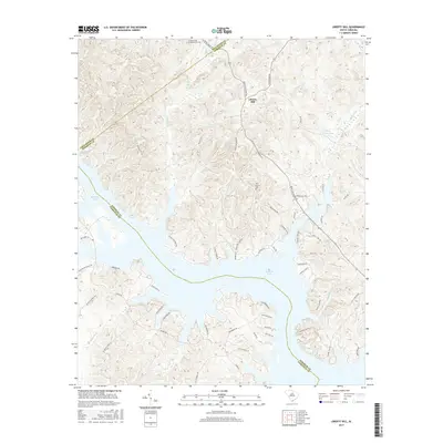
2017 Map of Liberty Hill
USGS Topo · Published 2017About this map
Liberty Hill sits high above the sprawling fingers of Wateree Lake, marking a landscape where the upland terrain of Kershaw County meets the flooded valleys of the Catawba River system. The settlement's historical depth is evidenced by sites like the Summerville - Cunningham Cem and New Grove Cem, while the natural hydrology is defined by numerous drainage points including Singleton Cr, Beaver Cr, and the specifically named Mineral Spring. The complex shoreline of the lake has dictated the modern road network, with routes like John G Richards RD and Stoneboro RD winding along the ridges. Notable local landmarks such as Hilton House Pond and the small tributary of Stillhouse Br provide specific points of interest for those studying the rural land use and water resources in this portion of South Carolina's Piedmont region.
Find a feature on this map
57 named features on this map. Tap any name to fly to it.
Don’t see what you’re looking for? This feature index may not catch every label — zoom into the map to look around manually.
Map Details
Editions of this 2017 Liberty Hill Map
This is the sole edition of this map. No revisions or reprints were ever made.
Other maps of this area

1935 · Camden
USGS Topo · 1:48,000

1938 · Camden
USGS Topo · 1:62,500

1941 · Spartanburg
USGS Topo · 1:250,000

1942 · Camden
USGS Topo · 1:125,000

1953 · Spartanburg
USGS Topo · 1:250,000

1960 · Spartanburg
USGS Topo · 1:250,000

1963 · Spartanburg
USGS Topo · 1:250,000

1964 · Spartanburg
USGS Topo · 1:250,000

1968 · Lancaster SE
USGS Topo · 1:24,000

1968 · Heath Springs
USGS Topo · 1:24,000