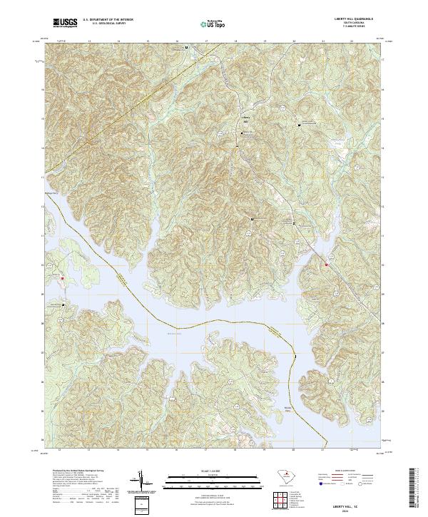
2024 Map of Liberty Hill
USGS Topo · Published 2024About this map
Liberty Hill sits atop the high ground where the borders of Lancaster and Kershaw counties meet, overlooking the intricate northern reaches of Wateree Lake. This modern survey illustrates a landscape defined by the intersection of colonial-era settlements and twentieth-century hydroelectric development. The village of Liberty Hill maintains its historical footprint with the Liberty Hill Presbyterian Church Graveyard serving as a central genealogical landmark. To the south, the irregular shoreline of the reservoir creates numerous coves and points, such as those near Rochelle Creek and Fox Creek. Historical river crossings, now part of the modern road network or submerged by the lake, are preserved in names like Peays Ferry and Mickles Ferry. The map also documents smaller interior landmarks like Hilton-House Pond and Mineral Spring, alongside several remote burial grounds including New Grove Cem and the Summerville-Cunningham Cem.
Find a feature on this map
86 named features on this map. Tap any name to fly to it.
Don’t see what you’re looking for? This feature index may not catch every label — zoom into the map to look around manually.
Map Details
Editions of this 2024 Liberty Hill Map
This is the sole edition of this map. No revisions or reprints were ever made.
Other maps of this area

1935 · Camden
USGS Topo · 1:48,000

1938 · Camden
USGS Topo · 1:62,500

1941 · Spartanburg
USGS Topo · 1:250,000

1942 · Camden
USGS Topo · 1:125,000

1953 · Spartanburg
USGS Topo · 1:250,000

1960 · Spartanburg
USGS Topo · 1:250,000

1963 · Spartanburg
USGS Topo · 1:250,000

1964 · Spartanburg
USGS Topo · 1:250,000

1968 · Lancaster SE
USGS Topo · 1:24,000

1968 · Heath Springs
USGS Topo · 1:24,000