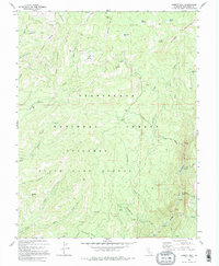
1979 Map of Liberty Hill
USGS Topo · Published 1995About this map
Stanislaus National Forest landscape, dominated by the Middle Fork Stanislaus River and high meadows, defines this 1970s survey. The terrain is marked by specific waypoints and seasonal habitations such as Snyder Camp and Post Corral, indicating a history of seasonal grazing or forestry management. In the northeastern corner, the Dardanelles rise above Whittakers Creek, while numerous smaller meadows like Beartrap Meadow and Shoofly Meadow are tucked into the drainage basins.
Find a feature on this map
47 named features on this map. Tap any name to fly to it.
Don’t see what you’re looking for? This feature index may not catch every label — zoom into the map to look around manually.
Map Details
Editions of this 1979 Liberty Hill Map
3 editions found
Other maps of this area

1891 · Big Trees
USGS Topo · 1:125,000

1894 · Big Trees
USGS Topo · 1:125,000

1896 · Dardanelles
USGS Topo · 1:125,000

1897 · Big Trees
USGS Topo · 1:125,000

1898 · Dardanelles
USGS Topo · 1:125,000

1901 · Big Trees
USGS Topo · 1:125,000

1947 · Sacramento
USGS Topo · 1:250,000

1948 · Walker Lake
USGS Topo · 1:250,000

1948 · Sacramento
USGS Topo · 1:250,000

1956 · Sacramento
USGS Topo · 1:250,000