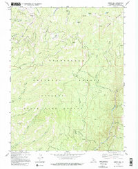
1979 Map of Liberty Hill
USGS Topo · Published 1995About this map
The Middle Fork Stanislaus River carves through the southeastern corner of this terrain, marked by Cascade Falls and several rapids as it flows past a small Quarry. This 1970s landscape, set within the Stanislaus National Forest, is defined by a network of seasonal meadows and specialized land use, including a large State Game Refuge that covers much of the southern half of the quadrangle. Remote outposts like Snyder Camp and Post Corral serve as landmarks in a high-elevation environment where water sources like Whittakers Spring and Sands Meadow Spring were critical for navigation.
Find a feature on this map
52 named features on this map. Tap any name to fly to it.
Don’t see what you’re looking for? This feature index may not catch every label — zoom into the map to look around manually.
Map Details
Editions of this 1979 Liberty Hill Map
3 editions found
Other maps of this area

1891 · Big Trees
USGS Topo · 1:125,000

1894 · Big Trees
USGS Topo · 1:125,000

1896 · Dardanelles
USGS Topo · 1:125,000

1897 · Big Trees
USGS Topo · 1:125,000

1898 · Dardanelles
USGS Topo · 1:125,000

1901 · Big Trees
USGS Topo · 1:125,000

1947 · Sacramento
USGS Topo · 1:250,000

1948 · Walker Lake
USGS Topo · 1:250,000

1948 · Sacramento
USGS Topo · 1:250,000

1956 · Sacramento
USGS Topo · 1:250,000