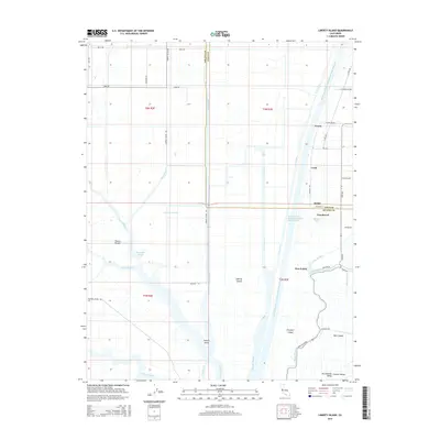
2015 Map of Liberty Island
USGS Topo · Published 2015About this map
The Sacramento River Deep Water Ship Channel dominates the aquatic geography of this region, cutting a straight north-south path through the low-lying terrain of the Sacramento Valley. This landscape is defined by its complex network of sloughs and cuts, including the Liberty Cut and Shag Slough, which isolate large tracts of land such as Liberty Island and French Island. These islands, bordered by the Toe Drain and Prospect Slough, demonstrate the engineering required to manage water in the Central Valley.
Find a feature on this map
53 named features on this map. Tap any name to fly to it.
Don’t see what you’re looking for? This feature index may not catch every label — zoom into the map to look around manually.
Map Details
Editions of this 2015 Liberty Island Map
This is the sole edition of this map. No revisions or reprints were ever made.
Other maps of this area

1907 · Antioch
USGS Topo · 1:62,500

1908 · Vacaville
USGS Topo · 1:62,500

1908 · Courtland
USGS Topo · 1:62,500

1908 · Antioch
USGS Topo · 1:62,500

1910 · Rio Vista
USGS Topo · 1:31,680

1910 · Isleton
USGS Topo · 1:31,680

1916 · Dixon
USGS Topo · 1:31,680

1916 · Cache Slough
USGS Topo · 1:31,680

1916 · Vorden
USGS Topo · 1:31,680

1916 · Maine Prairie
USGS Topo · 1:31,680