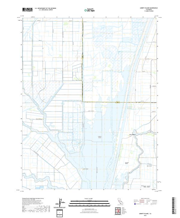
2022 Map of Liberty Island
USGS Topo · Published 2022About this map
Liberty Island and its surrounding delta environment define this section of the Sacramento Valley at the border of Solano and Yolo counties. The landscape is a complex network of reclaimed islands and engineered waterways, dominated by the massive Sacramento River Deep Water Ship Channel and various cuts like Hastings Cut and Liberty Cut. This intricate system of sloughs, including Shag Slough, Cache Slough, and Miner Slough, illustrates the region's total reliance on water management for agriculture and maritime navigation.
Find a feature on this map
47 named features on this map. Tap any name to fly to it.
Don’t see what you’re looking for? This feature index may not catch every label — zoom into the map to look around manually.
Map Details
Editions of this 2022 Liberty Island Map
This is the sole edition of this map. No revisions or reprints were ever made.
Other maps of this area

1907 · Antioch
USGS Topo · 1:62,500

1908 · Vacaville
USGS Topo · 1:62,500

1908 · Courtland
USGS Topo · 1:62,500

1908 · Antioch
USGS Topo · 1:62,500

1910 · Rio Vista
USGS Topo · 1:31,680

1910 · Isleton
USGS Topo · 1:31,680

1916 · Dixon
USGS Topo · 1:31,680

1916 · Cache Slough
USGS Topo · 1:31,680

1916 · Vorden
USGS Topo · 1:31,680

1916 · Maine Prairie
USGS Topo · 1:31,680