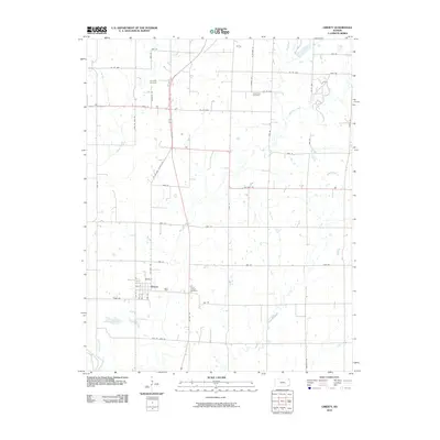
2010 Map of Liberty
USGS Topo · Published 2010About this map
The settlement of Liberty anchors this Montgomery County landscape, positioned at the intersection of a modernized transport network and historic local corridors. Situated south of the US Hwy 160 junction, the community is defined by its grid of streets such as North St and Elm St, while the bypass of US Hwy 169 runs parallel to the original route, Old Hwy 169. The rural surroundings are notably rich in burial grounds, including Saint Joseph Cemetery to the east and Harmony Cemetery to the north, which serve as vital landmarks for genealogists tracking early families in the region. The drainage of the area is carved by several meandering waterways, most notably Big Hill Creek and Potato Creek, which weave between a dense network of sectional county roads like Co Rd 4400 and 3600 Rd.
Find a feature on this map
39 named features on this map. Tap any name to fly to it.
Don’t see what you’re looking for? This feature index may not catch every label — zoom into the map to look around manually.
Map Details
Editions of this 2010 Liberty Map
This is the sole edition of this map. No revisions or reprints were ever made.
Other maps of this area

1886 · Independence
USGS Topo · 1:125,000

1886 · Parsons
USGS Topo · 1:125,000

1893 · Parsons
USGS Topo · 1:125,000

1894 · Independence
USGS Topo · 1:125,000

1905 · Independence
USGS Topo · 1:125,000

1945 · Parsons
USGS Topo · 1:62,500

1946 · Parsons
USGS Topo · 1:62,500

1946 · Mound Valley
USGS Topo · 1:62,500

1947 · Parsons
USGS Topo · 1:62,500

1947 · Joplin
USGS Topo · 1:250,000