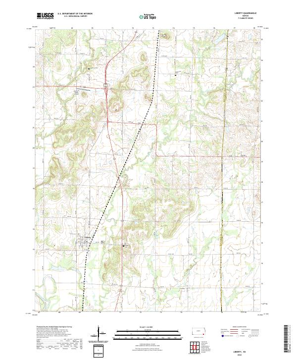
2022 Map of Liberty
USGS Topo · Published 2022About this map
The town of Liberty anchors this landscape in southeastern Kansas, situated near the confluence of Cotton Cr and the Verdigris River. This modern topographic survey illustrates a rural environment defined by the agricultural grid of Montgomery and Labette counties, where numerous creek systems like Big Hill Cr and Potato Cr cut through the plains. Local history and genealogy interest is concentrated in several rural burial grounds, including Harmony Cem to the north and Centennial Cem near the Labette County line. The presence of the Harmony Valley Airport north of town highlights the area's ongoing connection to regional transportation, while the rectilinear road network, composed of routes like 4200 RD and 5700 RD, maintains the traditional section lines established during the early settlement of the region.
Find a feature on this map
67 named features on this map. Tap any name to fly to it.
Don’t see what you’re looking for? This feature index may not catch every label — zoom into the map to look around manually.
Map Details
Editions of this 2022 Liberty Map
This is the sole edition of this map. No revisions or reprints were ever made.
Other maps of this area

1886 · Independence
USGS Topo · 1:125,000

1886 · Parsons
USGS Topo · 1:125,000

1893 · Parsons
USGS Topo · 1:125,000

1894 · Independence
USGS Topo · 1:125,000

1905 · Independence
USGS Topo · 1:125,000

1945 · Parsons
USGS Topo · 1:62,500

1946 · Parsons
USGS Topo · 1:62,500

1946 · Mound Valley
USGS Topo · 1:62,500

1947 · Parsons
USGS Topo · 1:62,500

1947 · Joplin
USGS Topo · 1:250,000