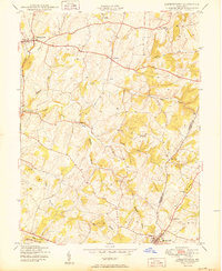
1950 Map of Libertytown
USGS Topo · Published 1950About this map
Parrs Ridge defines the eastern topography of this region along the Frederick and Carroll county line, serving as a high-ground anchor for agricultural development at the mid-century. The landscape is interconnected by a network of drainage systems, most notably Linganore Creek and its diverging North Fork and South Fork. These waterways historically dictated the placement of small rural hubs like Woodville and Linganore.
Find a feature on this map
26 named features on this map. Tap any name to fly to it.
Don’t see what you’re looking for? This feature index may not catch every label — zoom into the map to look around manually.
Map Details
Editions of this 1950 Libertytown Map
2 editions found
Other maps of this area

1893 · Frederick
USGS Topo · 1:125,000

1894 · Frederick
USGS Topo · 1:125,000

1908 · Ijamsville
USGS Topo · 1:62,500

1909 · Mount Airy
USGS Topo · 1:62,500

1909 · Ijamsville
USGS Topo · 1:62,500

1911 · Taneytown
USGS Topo · 1:62,500

1911 · Emmitsburg
USGS Topo · 1:62,500

1942 · Frederick
USGS Topo · 1:62,500

1942 · Gettysburg
USGS Topo · 1:125,000

1943 · Emmitsburg
USGS Topo · 1:62,500