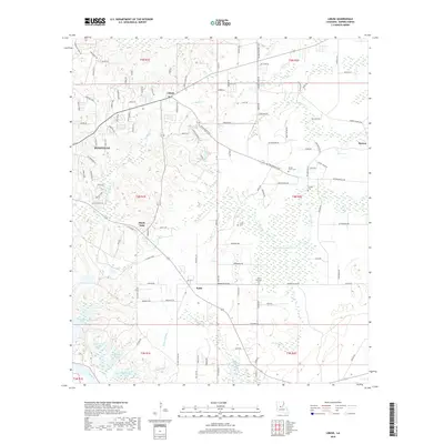
2018 Map of Libuse
USGS Topo · Published 2018About this map
Central Louisiana's rural landscape in Rapides Parish is defined here by the distinct heritage of its small settlements and the winding course of the Red River. The community of Libuse and its namesake Libuse Czech Cem speak to the unique Bohemian and Czech settlement history in this region, a legacy mirrored further south in Kolin and the Czech National Cem. These pockets of local history are surrounded by a dense network of water bodies, including Wiggins Bayou and Horsepen Cr, which drain the low-lying terrain near Pineville. The map reveals how local families have left their mark on the landscape through sites like Hooper Cem and Craig Cem, as well as small neighborhoods like Shady Oaks and Barron. As the land slopes toward the river, a series of oxbow-style lakes including Buttonwood Lake, Rock Island Lake, and Tanyard Lake reveal the shifting hydrology of the river basin.
Find a feature on this map
121 named features on this map. Tap any name to fly to it.
Don’t see what you’re looking for? This feature index may not catch every label — zoom into the map to look around manually.
Map Details
Editions of this 2018 Libuse Map
This is the sole edition of this map. No revisions or reprints were ever made.
Other maps of this area

1935 · Lecompte
USGS Topo · 1:62,500

1940 · Marksville
USGS Topo · 1:62,500

1941 · Alexandria
USGS Topo · 1:62,500

1941 · Buckeye
USGS Topo · 1:62,500

1953 · Alexandria
USGS Topo · 1:250,000

1955 · Alexandria
USGS Topo · 1:250,000

1957 · Alexandria
USGS Topo · 1:62,500
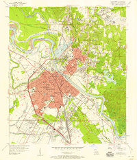
1957 · Alexandria
USGS Topo · 1:24,000

1957 · Lecompte
USGS Topo · 1:62,500

1959 · Buckeye
USGS Topo · 1:62,500