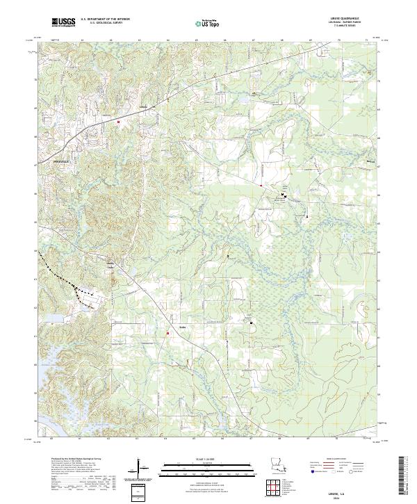
2024 Map of Libuse
USGS Topo · Published 2024About this map
Settlements of Czech heritage define this pocket of Rapides Parish, where the communities of Libuse and Kolin serve as cultural anchors. The landscape is dotted with several dedicated burial grounds, including the Libuse Czech Cem and the Czech National Cem, reflecting the specific immigrant history of the area. These settlements are established on the higher ground north of the Red River basin, separated by a network of small waterways like Brushy Fork and Little Horsepen Creek.
Find a feature on this map
124 named features on this map. Tap any name to fly to it.
Don’t see what you’re looking for? This feature index may not catch every label — zoom into the map to look around manually.
Map Details
Editions of this 2024 Libuse Map
This is the sole edition of this map. No revisions or reprints were ever made.
Other maps of this area

1935 · Lecompte
USGS Topo · 1:62,500

1940 · Marksville
USGS Topo · 1:62,500

1941 · Alexandria
USGS Topo · 1:62,500

1941 · Buckeye
USGS Topo · 1:62,500

1953 · Alexandria
USGS Topo · 1:250,000

1955 · Alexandria
USGS Topo · 1:250,000

1957 · Alexandria
USGS Topo · 1:62,500
1957 · Alexandria
USGS Topo · 1:24,000

1957 · Lecompte
USGS Topo · 1:62,500

1959 · Buckeye
USGS Topo · 1:62,500