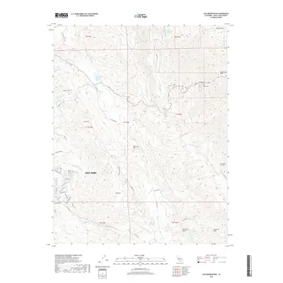
2018 Map of Lick Observatory
USGS Topo · Published 2018About this map
The Lick Observatory stands as the central landmark of this landscape, perched atop Mt Hamilton in the Diablo Range. The 2018 survey reveals a sharp contrast between the dense residential expansion of San Jose along the western edge—marked by neighborhoods like The Villages Pkwy and Silver Creek Rd—and the undeveloped, mountainous terrain to the east. Higher elevations are characterized by peaks such as Copernicus Peak and Mt Misery, separated by the internal drainage of Halls Valley and its Halls Valley Lake. The map details the complex winding route of Mt Hamilton Rd as it navigates the steep ascent toward the summit, passing through high-altitude features like Mount Hamilton Springs and overlooking the rural reaches of San Felipe Valley.
Find a feature on this map
61 named features on this map. Tap any name to fly to it.
Don’t see what you’re looking for? This feature index may not catch every label — zoom into the map to look around manually.
Map Details
Editions of this 2018 Lick Observatory Map
This is the sole edition of this map. No revisions or reprints were ever made.
Other maps of this area

1889 · San Jose
USGS Topo · 1:62,500

1897 · San Jose
USGS Topo · 1:62,500

1897 · Mt. Hamilton
USGS Topo · 1:62,500

1899 · San Jose
USGS Topo · 1:62,500

1916 · New Almaden
USGS Topo · 1:48,000

1917 · Morgan Hill
USGS Topo · 1:62,500

1919 · New Almaden
USGS Topo · 1:62,500

1939 · Morgan Hill
USGS Topo · 1:62,500

1940 · Los Gatos
USGS Topo · 1:62,500

1941 · Morgan Hill
USGS Topo · 1:62,500