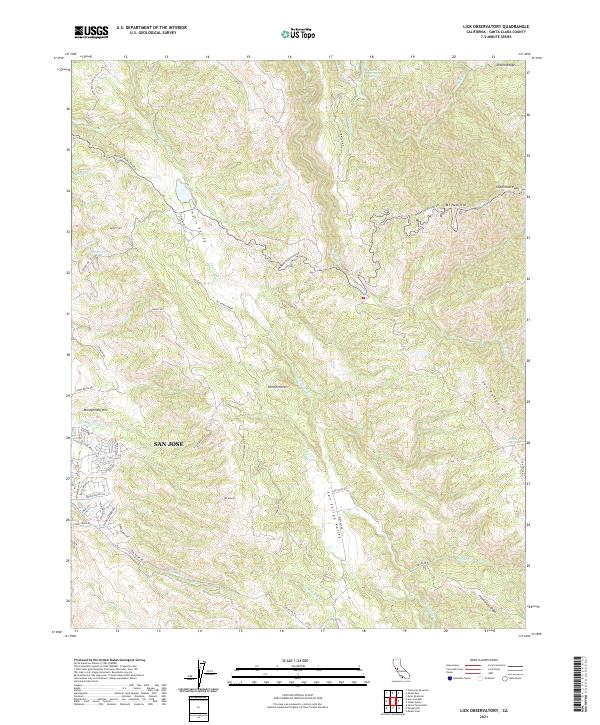
2021 Map of Lick Observatory
USGS Topo · Published 2021About this map
Mt Hamilton and the high ridges of the Diablo Range dominate this corner of Santa Clara County, where the winding Mount Hamilton Rd climbs toward Copernicus Peak. The landscape transitions from the eastern suburban reaches of San Jose, including developments near Montgomery Hill and Silver Creek Rd, into the expansive, sparsely populated terrain of the interior mountains. This area is defined by sharp elevation changes and secluded valleys like Halls Valley and the San Felipe Valley.
Find a feature on this map
51 named features on this map. Tap any name to fly to it.
Don’t see what you’re looking for? This feature index may not catch every label — zoom into the map to look around manually.
Map Details
Editions of this 2021 Lick Observatory Map
This is the sole edition of this map. No revisions or reprints were ever made.
Other maps of this area

1889 · San Jose
USGS Topo · 1:62,500

1897 · San Jose
USGS Topo · 1:62,500

1897 · Mt. Hamilton
USGS Topo · 1:62,500

1899 · San Jose
USGS Topo · 1:62,500

1916 · New Almaden
USGS Topo · 1:48,000

1917 · Morgan Hill
USGS Topo · 1:62,500

1919 · New Almaden
USGS Topo · 1:62,500

1939 · Morgan Hill
USGS Topo · 1:62,500

1940 · Los Gatos
USGS Topo · 1:62,500

1941 · Morgan Hill
USGS Topo · 1:62,500