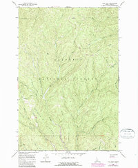
1966 Map of Lick Point
USGS Topo · Published 1987About this map
Dredge Tailings along the American River reveal the legacy of mineral extraction in this corner of the Nez Perce National Forest. Published in 1987 based on 1960s field data, the map illustrates a landscape defined by sharp elevation changes and a dense drainage network. High points like Lick Point and Anderson Butte overlook steep valleys carved by waterways such as Wart Creek, Horse Creek, and Big Elk Creek.
Find a feature on this map
30 named features on this map. Tap any name to fly to it.
Don’t see what you’re looking for? This feature index may not catch every label — zoom into the map to look around manually.
Map Details
Editions of this 1966 Lick Point Map
2 editions found

Other maps of this area

1911 · Lolo
USGS Topo · 1:250,000

1913 · Lolo
USGS Topo · 1:250,000

1924 · Weippe
USGS Topo · 1:125,000

1931 · Buffalo Hump
USGS Topo · 1:125,000

1934 · Buffalo Hump
USGS Topo · 1:125,000

1956 · Elk City
USGS Topo · 1:250,000

1956 · Hamilton
USGS Topo · 1:250,000

1959 · Hamilton
USGS Topo · 1:250,000

1960 · Elk City
USGS Topo · 1:250,000

1960 · Hamilton
USGS Topo · 1:250,000