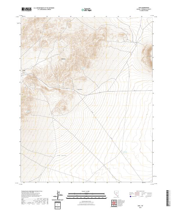
2021 Map of Lida
USGS Topo · Published 2021About this map
Lida stands as a primary point of interest in this high-desert region of Esmeralda County, situated where the mountain slopes meet the basin. The landscape is defined by the steep rises of the Palmetto Mountains and the prominent peak of Mt Jackson to the east. Transportation through this arid terrain follows the path of Lida Canyon via State Route 266, a route historically vital for connecting isolated mining districts and ranching outposts. Water sources, though sparse, are critical landmarks in this environment, including Last Water Spring, Stewarts Spring, and the Pipeline Reservoir. The map illustrates a transition from the rugged highlands down into the broad expanse of Lida Valley, showing how the sparse road network like Lida Rd navigates the natural topography of the Great Basin.
Find a feature on this map
14 named features on this map. Tap any name to fly to it.
Don’t see what you’re looking for? This feature index may not catch every label — zoom into the map to look around manually.
Map Details
Editions of this 2021 Lida Map
This is the sole edition of this map. No revisions or reprints were ever made.
Other maps of this area

1898 · Silver Peak
USGS Topo · 1:125,000

1900 · Silver Peak
USGS Topo · 1:125,000

1908 · Lida
USGS Topo · 1:250,000

1913 · Lida
USGS Topo · 1:250,000

1945 · Goldfield
USGS Topo · 1:125,000

1954 · Goldfield
USGS Topo · 1:250,000

1955 · Goldfield
USGS Topo · 1:250,000

1957 · Magruder Mtn
USGS Topo · 1:62,500

1958 · Goldfield
USGS Topo · 1:250,000

1962 · Goldfield
USGS Topo · 1:250,000