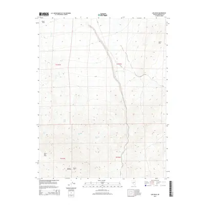
2014 Map of Lida Wash
USGS Topo · Published 2014About this map
Lida Wash snakes through the arid basin of Esmeralda County, defining a landscape shaped by scarce water sources and dramatic topographic shifts. To the north, the terrain descends into the low-lying Clayton Valley, while the southern reaches are dominated by the high elevations of the Palmetto Mountains and Silver Peak Range. Harvey Peak stands as a prominent landmark in the southwest, overlooking a series of critical water points that historically sustained movement through this desert corridor.
Find a feature on this map
18 named features on this map. Tap any name to fly to it.
Don’t see what you’re looking for? This feature index may not catch every label — zoom into the map to look around manually.
Map Details
Editions of this 2014 Lida Wash Map
This is the sole edition of this map. No revisions or reprints were ever made.
Other maps of this area

1898 · Silver Peak
USGS Topo · 1:125,000

1900 · Silver Peak
USGS Topo · 1:125,000

1908 · Lida
USGS Topo · 1:250,000

1913 · Lida
USGS Topo · 1:250,000

1945 · Goldfield
USGS Topo · 1:125,000

1954 · Goldfield
USGS Topo · 1:250,000

1955 · Goldfield
USGS Topo · 1:250,000

1957 · Magruder Mtn
USGS Topo · 1:62,500

1958 · Goldfield
USGS Topo · 1:250,000

1962 · Goldfield
USGS Topo · 1:250,000