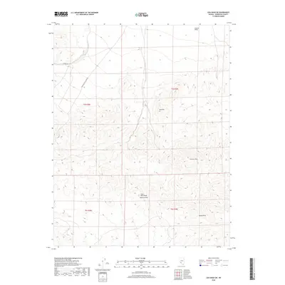
2018 Map of Lida Wash SW
USGS Topo · Published 2018About this map
The Silver Peak Range dominates this desert landscape, reaching a high point at Palmetto Peak in the southern portion of the quadrangle. This high-altitude terrain transition is marked by several distinct summits, including Harlans Peak, Pearsons Peak, and Jims Peak. To the north, the elevation drops toward the southern margins of Clayton Valley, a prominent endorheic basin. Infrastructure in this arid region of Esmeralda County is sparse, defined primarily by rugged thoroughfares like McAfee Rd and the Silver Peak-Oasis Divide Rd. The map illustrates a landscape of extreme relief and limited human development, where surveying is organized by the Public Land Survey System grids including t4s r38e and t5s r39e, reflecting the remote character of the Nevada backcountry in the 21st century.
Find a feature on this map
12 named features on this map. Tap any name to fly to it.
Don’t see what you’re looking for? This feature index may not catch every label — zoom into the map to look around manually.
Map Details
Editions of this 2018 Lida Wash SW Map
This is the sole edition of this map. No revisions or reprints were ever made.
Other maps of this area

1898 · Silver Peak
USGS Topo · 1:125,000

1900 · Silver Peak
USGS Topo · 1:125,000

1908 · Lida
USGS Topo · 1:250,000

1913 · Lida
USGS Topo · 1:250,000

1954 · Goldfield
USGS Topo · 1:250,000

1955 · Goldfield
USGS Topo · 1:250,000

1957 · Magruder Mtn
USGS Topo · 1:62,500

1958 · Goldfield
USGS Topo · 1:250,000

1958 · Soldier Pass
USGS Topo · 1:62,500

1962 · Goldfield
USGS Topo · 1:250,000