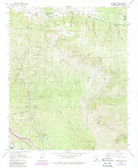
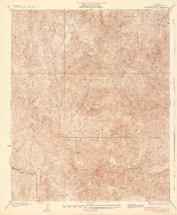
1958 Map of Liebre Mountain
USGS Topo · Published 1988About this map
The San Andreas Rift Zone cuts a distinct path across this mountain landscape, marking the tectonic boundary near the northern edge of the Angeles National Forest. In the late 1950s, the historic Old Ridge Route served as a primary artery through these canyons, passing the small settlement of Sandberg and the U S Weather Bureau Sta. The map reveals a network of service points for mid-century travelers and forest workers, including the Halfway Inn, Tumble Inn, and the Quail Lake Fire Sta. Mining and ranching interests are scattered throughout the steep terrain, evidenced by the Gillette Mine and the Paradox Prospect near Redrock Mountain. Water management for the region is highlighted by the Reservoir Summit and several named springs, illustrating the infrastructure required to sustain remote camps like Bear Gulch Camp and private holdings such as the Pine Grove Ranch.
Find a feature on this map
56 named features on this map. Tap any name to fly to it.
Don’t see what you’re looking for? This feature index may not catch every label — zoom into the map to look around manually.
Map Details
Editions of this 1958 Liebre Mountain Map
4 editions found
Other maps of this area

1903 · Tejon
USGS Topo · 1:125,000

1931 · Redrock Mtn
USGS Topo · 1:24,000

1932 · Beartrap Canyon
USGS Topo · 1:24,000

1932 · Neenach
USGS Topo · 1:24,000

1933 · Quail
USGS Topo · 1:24,000
1936 · Redrock Mtn.
USGS Topo · 1:24,000

1938 · Beartrap Canyon
USGS Topo · 1:24,000

1938 · Liebre
USGS Topo · 1:24,000

1938 · Quail
USGS Topo · 1:24,000

1943 · Neenach
USGS Topo · 1:62,500