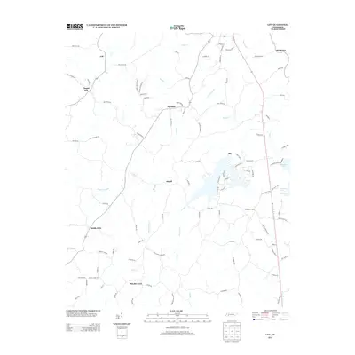
2013 Map of Life
USGS Topo · Published 2013About this map
The Tennessee-Valley Divide cuts through this portion of Henderson County, separating the drainage systems of the Tennessee River and the Mississippi River. The landscape is defined by small, dispersed rural settlements such as Life, Palestine, and Rhodes Town, connected by a network of winding roads like Peckerwood Rd and Poorhouse Rd. This area reflects the traditional agricultural and residential patterns of West Tennessee before significant modern expansion, with community centers often centered around intersections or local waterways like Piney Creek and Wolf Cr. To the east, the impoundment of Sycamore Lake introduces a larger water feature into the rolling terrain near Center Hill. Genealogists and local historians can trace family locations through markers like Mullins Cemetery Rd and Mount Zion Cemetery Rd, which point to established centers of community life and burial sites across the quadrangle.
Find a feature on this map
102 named features on this map. Tap any name to fly to it.
Don’t see what you’re looking for? This feature index may not catch every label — zoom into the map to look around manually.
Map Details
Editions of this 2013 Life Map
This is the sole edition of this map. No revisions or reprints were ever made.
Other maps of this area

1936 · Lexington
USGS Topo · 1:24,000

1936 · Sardis
USGS Topo · 1:24,000

1936 · Reagan
USGS Topo · 1:24,000

1936 · Enville
USGS Topo · 1:24,000

1936 · Life
USGS Topo · 1:24,000

1936 · Chesterfield
USGS Topo · 1:24,000
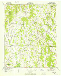
1949 · Sardis
USGS Topo · 1:24,000

1950 · Reagan
USGS Topo · 1:24,000

1950 · Life
USGS Topo · 1:24,000

1950 · Enville
USGS Topo · 1:24,000