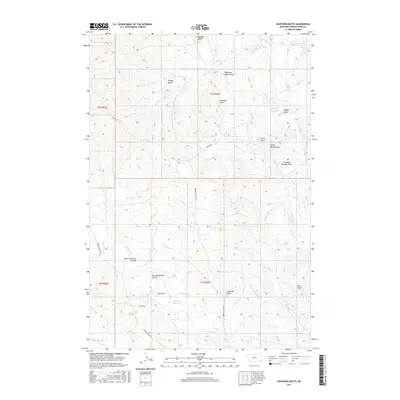
2017 Map of Lightning Butte
USGS Topo · Published 2017About this map
Lightning Butte and Pine Butte rise above the high plains of Powder River County in this recent survey of southeastern Montana. The landscape is defined by an intricate network of drainage systems, including Cabin Cr to the north and the multi-pronged Lightning Cr to the south. The presence of water management features like Vannett Reservoir, Moody Reservoir, and the CCC Reservoir indicates the critical importance of water storage for ranching and land use in this arid region.
Find a feature on this map
33 named features on this map. Tap any name to fly to it.
Don’t see what you’re looking for? This feature index may not catch every label — zoom into the map to look around manually.
Map Details
Editions of this 2017 Lightning Butte Map
This is the sole edition of this map. No revisions or reprints were ever made.
Other maps of this area

1954 · Ekalaka
USGS Topo · 1:250,000

1956 · Ekalaka
USGS Topo · 1:250,000

1958 · Ekalaka
USGS Topo · 1:250,000

1965 · Ekalaka
USGS Topo · 1:250,000

1979 · Deer Creek Buttes
USGS Topo · 1:24,000

1979 · McKenzie Creek
USGS Topo · 1:24,000
1979 · Pocochichee Butte
USGS Topo · 1:24,000

1980 · Broadus
USGS Topo · 1:100,000

1981 · Alzada
USGS Topo · 1:100,000
1982 · Knudson Draw
USGS Topo · 1:24,000