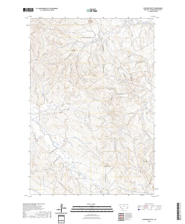
2024 Map of Lightning Butte
USGS Topo · Published 2024About this map
Lightning Butte and Pine Butte anchor this high plains landscape in Powder River County, where drainage patterns define the local geography. The territory is marked by a network of ephemeral water sources and man-made impoundments such as Moody Reservoir, CCC Reservoir, and Vannett Reservoir, illustrating the critical importance of water management in this arid region. These basins collect runoff from a complex system of draws and coulees, including McKenzie Spring Draw, Stills Draw, and the West Ainsworth Coulee. Settlement patterns are traced through a series of local connectors like Moore Rd and Pilgrim Creek Rd, which provide access between ranching lands and primary watercourses like Cabin Creek and Pilgrim Creek. The map also captures several distinct elevations such as Buffalo Butte and Shipley Butte, which serve as prominent navigational landmarks across the undulating terrain.
Find a feature on this map
33 named features on this map. Tap any name to fly to it.
Don’t see what you’re looking for? This feature index may not catch every label — zoom into the map to look around manually.
Map Details
Editions of this 2024 Lightning Butte Map
This is the sole edition of this map. No revisions or reprints were ever made.
Other maps of this area

1954 · Ekalaka
USGS Topo · 1:250,000

1956 · Ekalaka
USGS Topo · 1:250,000

1958 · Ekalaka
USGS Topo · 1:250,000

1965 · Ekalaka
USGS Topo · 1:250,000

1979 · Deer Creek Buttes
USGS Topo · 1:24,000

1979 · McKenzie Creek
USGS Topo · 1:24,000
1979 · Pocochichee Butte
USGS Topo · 1:24,000

1980 · Broadus
USGS Topo · 1:100,000

1981 · Alzada
USGS Topo · 1:100,000
1982 · Knudson Draw
USGS Topo · 1:24,000