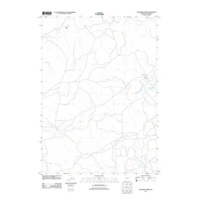
2012 Map of Lightning Creek
USGS Topo · Published 2012About this map
Lightning Cr carves a winding path through this portion of Converse County, defining a landscape of high plains drainage and ranching activity. The 2012 topography shows a network of seasonal waterways and draws, including Mikes Draw in the north and the headwaters of Box Cr, which feed into the larger regional basins. Human presence is concentrated at the Werner Ranch, situated near the confluence of local streams and the small Goochy Reservoir. This modern survey illustrates how water management remains central to life in the Wyoming interior, where man-made catchments like Goochy provide essential resources amidst the arid surroundings. The southern reaches are marked by the meandering course of Willow Cr, highlighting the importance of these riparian corridors for local navigation and land division.
Find a feature on this map
6 named features on this map. Tap any name to fly to it.
Don’t see what you’re looking for? This feature index may not catch every label — zoom into the map to look around manually.
Map Details
Editions of this 2012 Lightning Creek Map
This is the sole edition of this map. No revisions or reprints were ever made.
Other maps of this area

1949 · Clausen Ranch
USGS Topo · 1:24,000

1950 · Clausen Ranch
USGS Topo · 1:24,000

1954 · Torrington
USGS Topo · 1:250,000

1955 · Newcastle
USGS Topo · 1:250,000

1958 · Torrington
USGS Topo · 1:250,000

1958 · Newcastle
USGS Topo · 1:250,000

1959 · Bill
USGS Topo · 1:62,500

1970 · Bill 4 SE
USGS Topo · 1:24,000

1970 · Walker Creek School
USGS Topo · 1:24,000

1970 · Bill 4 NW
USGS Topo · 1:24,000